


Aerial view of Tarim Desert Highway in China's Xinjiang
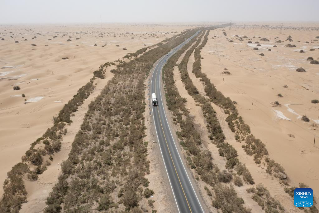
An aerial drone photo taken on July 18, 2025 shows a section of the Tarim Desert Highway and the shelterbelt planted along it in northwest China's Xinjiang Uygur Autonomous Region. The 522-km highway runs across the Taklimakan Desert, the world's second-largest shifting sand desert. (Xinhua/Meng Tao)
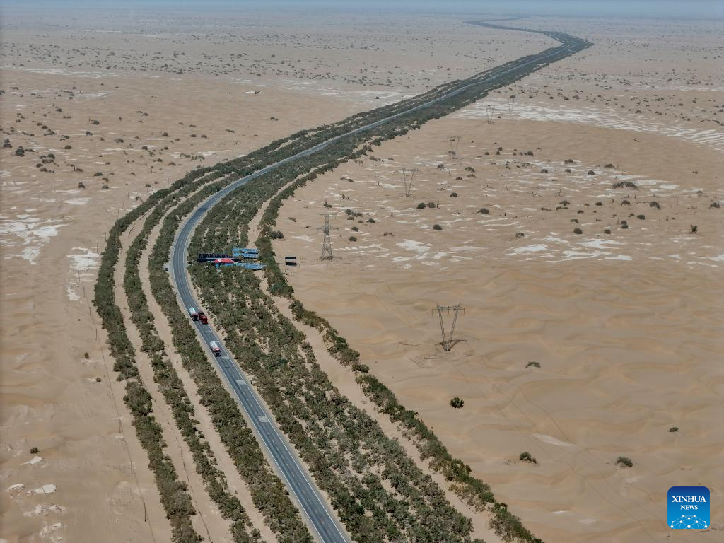
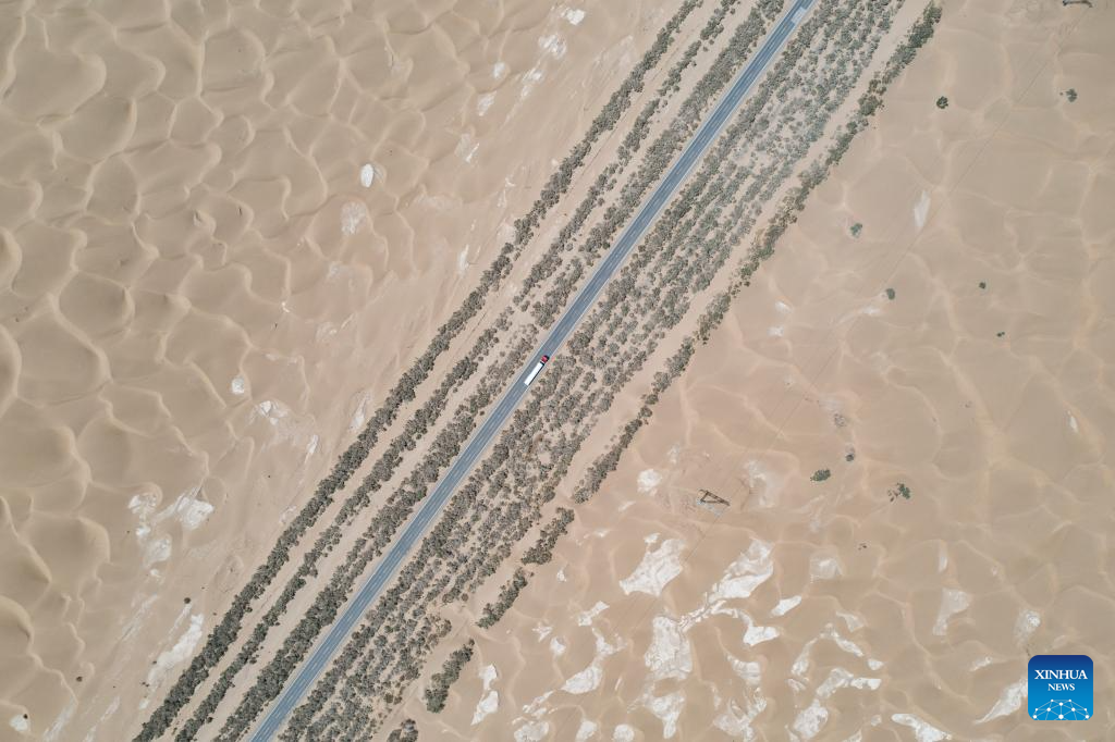
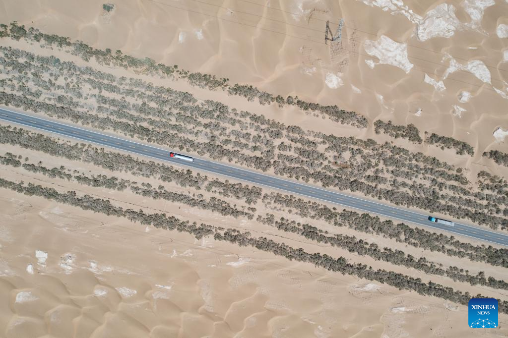
An aerial drone photo taken on July 18, 2025 shows the Tarim Desert Highway traversing through the Taklimakan Desert and the shelterbelt planted along it in northwest China's Xinjiang Uygur Autonomous Region. The 522-km highway runs across the Taklimakan Desert, the world's second-largest shifting sand desert. (Xinhua/Hu Huhu)
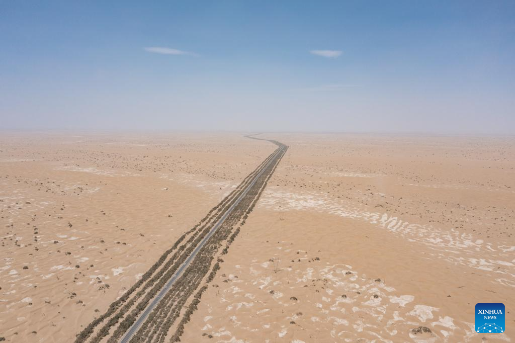
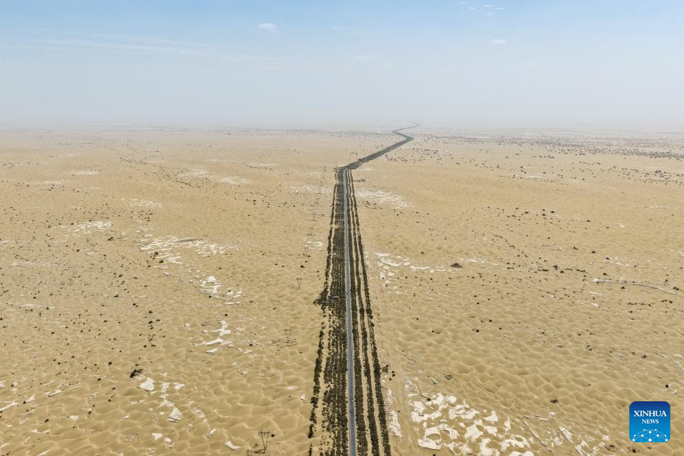
An aerial drone photo taken on July 18, 2025 shows the Tarim Desert Highway traversing through the Taklimakan Desert in northwest China's Xinjiang Uygur Autonomous Region. The 522-km highway runs across the Taklimakan Desert, the world's second-largest shifting sand desert. (Xinhua/Zhang Keren)
An aerial drone photo taken on July 18, 2025 shows the Tarim Desert Highway traversing through the Taklimakan Desert and the shelterbelt planted along it in northwest China's Xinjiang Uygur Autonomous Region. The 522-km highway runs across the Taklimakan Desert, the world's second-largest shifting sand desert. (Xinhua/Hu Huhu)
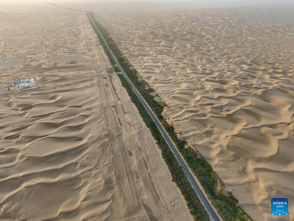
An aerial drone photo taken on July 19, 2025 shows a section of the Tarim Desert Highway and the shelterbelt planted along it in northwest China's Xinjiang Uygur Autonomous Region. The 522-km highway runs across the Taklimakan Desert, the world's second-largest shifting sand desert. (Xinhua/Meng Tao)
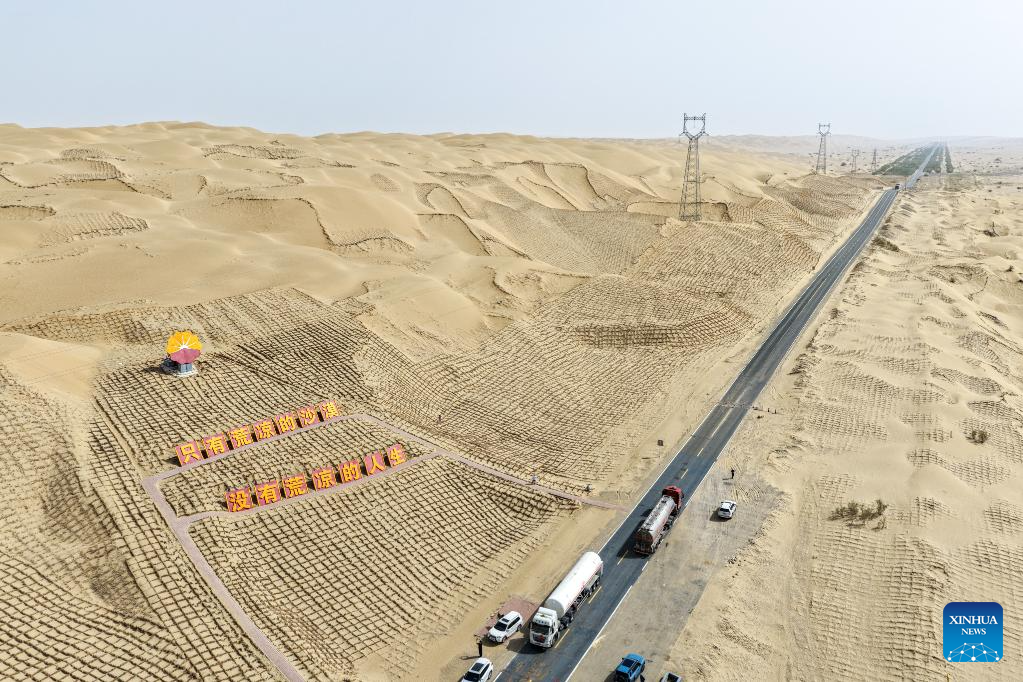
An aerial drone photo taken on July 18, 2025 shows a section of the Tarim Desert Highway and the shelterbelt planted along it in northwest China's Xinjiang Uygur Autonomous Region. The 522-km highway runs across the Taklimakan Desert, the world's second-largest shifting sand desert. (Xinhua/Meng Tao)
An aerial drone photo taken on July 18, 2025 shows a section of the Tarim Desert Highway and the shelterbelt planted along it in northwest China's Xinjiang Uygur Autonomous Region. The 522-km highway runs across the Taklimakan Desert, the world's second-largest shifting sand desert. (Xinhua/Meng Tao)
An aerial drone photo taken on July 18, 2025 shows the Tarim Desert Highway traversing through the Taklimakan Desert and the shelterbelt planted along it in northwest China's Xinjiang Uygur Autonomous Region. The 522-km highway runs across the Taklimakan Desert, the world's second-largest shifting sand desert. (Xinhua/Zhang Keren)
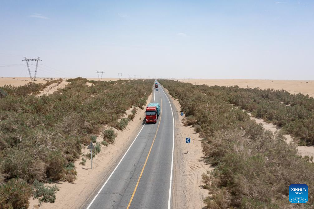
An aerial drone photo taken on July 18, 2025 shows a section of the Tarim Desert Highway and the shelterbelt planted along it in northwest China's Xinjiang Uygur Autonomous Region. The 522-km highway runs across the Taklimakan Desert, the world's second-largest shifting sand desert. (Xinhua/Meng Tao)

An aerial drone photo taken on July 18, 2025 shows the Tarim Desert Highway traversing through the Taklimakan Desert and the shelterbelt planted along it in northwest China's Xinjiang Uygur Autonomous Region. The 522-km highway runs across the Taklimakan Desert, the world's second-largest shifting sand desert. (Xinhua/Zhang Keren)
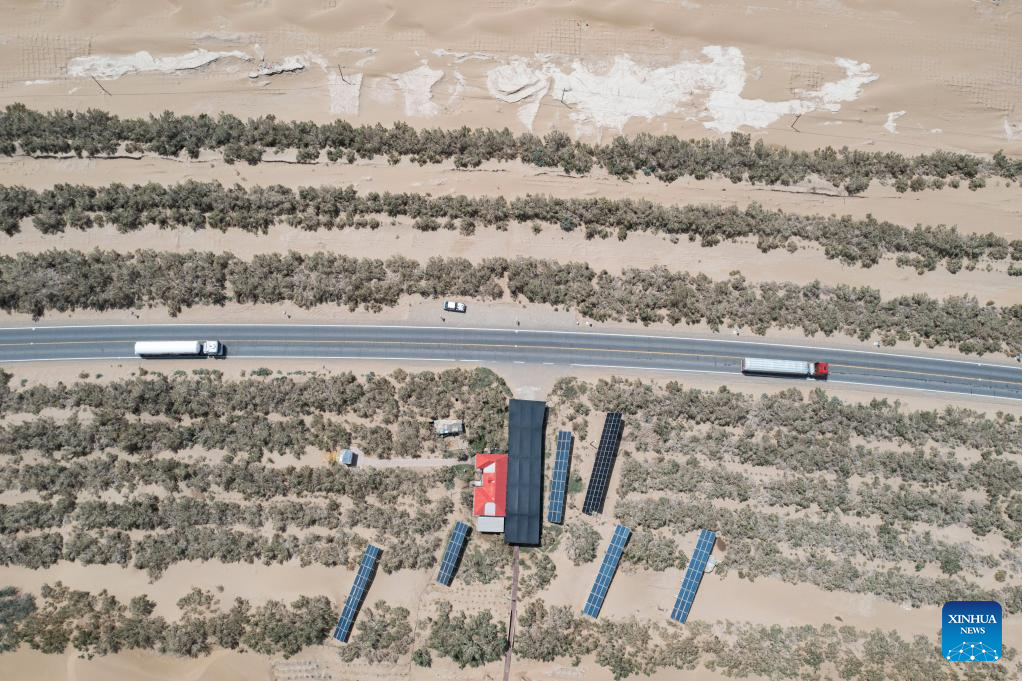
An aerial drone photo taken on July 18, 2025 shows a section of the Tarim Desert Highway and the shelterbelts planted along it in northwest China's Xinjiang Uygur Autonomous Region. The 522-kilometer highway runs across the Taklimakan Desert, the world's second-largest shifting sand desert. (Xinhua/Meng Tao)
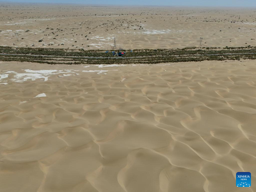
An aerial drone photo taken on July 18, 2025 shows the Tarim Desert Highway traversing through the Taklimakan Desert and the shelterbelts planted along it in northwest China's Xinjiang Uygur Autonomous Region. The 522-kilometer highway runs across the Taklimakan Desert, the world's second-largest shifting sand desert. (Xinhua/Hu Huhu)
Photos


Related Stories
- One road, 18 lanes
- 2322-km-long Yinchuan-Kunming highway opens to traffic
- Stunning?view?near expressway in E China’s Jiangxi
- Tree-lined highway traverses China's largest desert
- Thrilling and beautiful Yizhao Highway
- Regions across China advance construction of tourist highways
- North China province closes highways as heavy snow forecast
- Wumengshan grand bridge on Nayong-Qinglong Expressway connected
- China's intelligently upgraded highways top 3,500 kilometers
- Feature: Chinese contractor braves heat to complete final stretch of Algeria's highway project
Copyright © 2025 People's Daily Online. All Rights Reserved.
